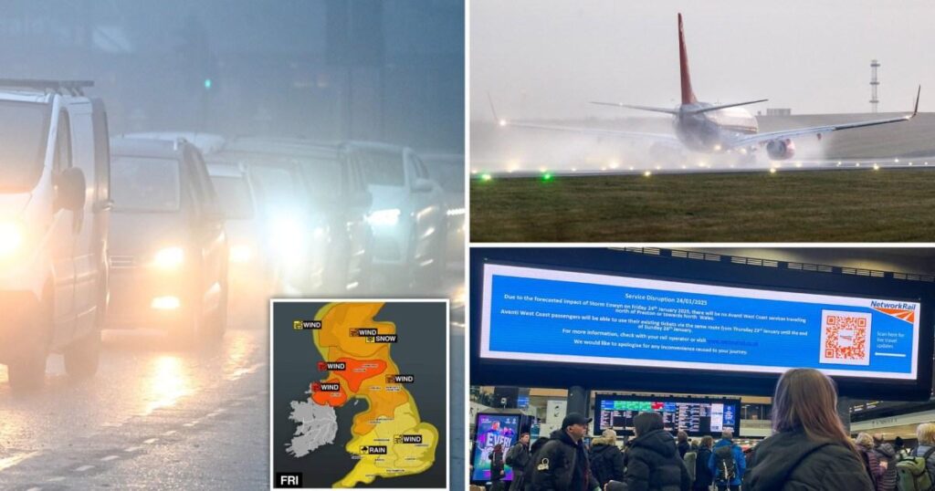
Storm Eowyn is bringing a weather bomb of tornados, strong winds, rain, snow – and travel disruption.
The officially named Storm Eowyn is approaching the UK and Ireland from the Atlantic, with the Met Office warning of ‘danger to life’ winds.
The first storm of the year is set to hit the UK tomorrow morning after landing in Ireland shortly after midnight. You can follow our live updates here.
All trains in Scotland have been suspended tomorrow. Other train operators and Network Rail have told passengers ‘do not travel’ tomorrow, while airports advised travellers to check with their airline before heading to the airport.
Here is a list of what to look out for if you have to travel by road, train, air or ferry tomorrow.
‘Do not travel’ train warnings
Several train operators have issued travel warnings for tomorrow ahead of Storm Eowyn, while ScotRail suspended
- Avanti West Coast – Do not travel north of Preston and on North Wales routes
- Northern – Do not travel warning on various routes, including Manchester-Leeds, Newcastle-Carlisle, Huddersfield-Sheffield and Blackpool North to York (via Bradford). A full list of affected routes can be found here

- CrossCountry – Do not travel between York, Newcastle and Edinburgh
- Grand Central and TransPennine services are affected
- LNER – Do not travel north of York
- Lumo – Do not travel north of Newcastle
- Merseyrail and Transport for Wales said there could be disruption, but they have not been affected today
What about UK flights?
Ryanair has said that there could be disruption to flights to and from Ireland during Storm Eowyn.
Airports in the area covered by the red wind warning said they are monitoring the situation with airlines, but the final decision to cancel or
Both Edinburgh and Belfast Airports told Metro passengers should continue to check with their airline.
A spokesperson for AGS Airports, which owns and operates Aberdeen, Glasgow and Southampton airports, said: ‘With adverse weather forecast for Friday and Saturday, passengers are advised to check the status of their flight with their airline before travelling.’
Road travel during Storm Eowyn

National Highways issued its own amber severe weather warning for gales in North West and North East England and Yorkshire between 7am and 10pm tomorrow.
It said winds will increase quickly through the morning and widely reach gusts of 60-70mph.
By midday, most of Cumbria, Durham and Northumberland will see ‘isolated gusts’ of 90mph, especially in the peak of the A66 Pennine route and coastal routes including the A590 and A595.
‘There is a particularly high risk that high-sided vehicles and other ‘vulnerable’ vehicles such as caravans and motorbikes could be blown over,’ it warned.

In Scotland, which is in the worst of the red warning area, the Forth Road Bridge is likely to close, while the Queensferry Crossing and Clackmannanshire Bridge are likely to close to high-sided vehicles, motorcycles and cars with trailers or roof boxes if winds reach 80mph.
Ports and ferries
Some ferry services from Ireland have already been axed.
Irish Ferries said that the 4pm ferry from Dublin to Cherbourg, France, today has been cancelled ‘due to adverse weather associated with storm Eowyn.’ The Cherbourg to Dublin ferry tomorrow is also axed.
Scotland’s west coast ferry operator CalMac warned the forecast conditions from Storm Eowyn mean the majority of sailings are liable to disruption or cancellation, with some services already axed.
Northlink Ferries, serving the Northern Isles, changed its sailing times tomorrow due to expected adverse weather, saying all sailings for Saturday are under review, with ‘a high probability of cancellation’ for morning ferries.
Get in touch with our news team by emailing us at webnews@metro.co.uk.
For more stories like this, check our news page.
MORE: UK’s worst tornados throughout history – and one that hit 213mph in 1666
MORE: Neighbours cast forced to buy coats in summer for very relatable reason
MORE: Map shows which parts of London could soon have a new Overground line


