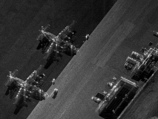
Ukraine has been scoring battlefield victories against Russia despite Russia having 10 times the GDP of the country it invaded. One of the reasons is simple, according to the Council for Scientific and Industrial Research’s (CSIR’s) chief Engineer for Radar and Technology and Innovation manager, Willie Nel: Ukraine has access to more satellites.
Speaking on day one of the inaugural Africa Aerospace and Defence (AAD) Conference, organised by defenceWeb, Nel said these aren’t military satellites but civilian ones and they are using Synthetic Aperture Radar (SAR), first developed in 1951 to create two dimensional images, to see through day and night, clouds, smoke and even trees, in ways that other technology can’t.
It’s all thanks to a new space race, said Nel, who delivered a presentation during the Future Warfare component of the AAD Conference. This began in2017 with the miniaturisation of SAR, which began life in the Lockheed U-2 spy plane and then segued to satellites in 1964. But it was only in 2006 that the weight of SAR devices came below 780 kg and then two years later below 300 kg. SAR payloads are small enough to be launched as microsatellites, including constellations, which is precisely what ICEYE, the Finnish American micro-satellite start up, began to do in 2015.
In 2017, there were a total of 24 microsatellites orbiting earth, by the following year, ICEYE itself had launched 38.
When Russia invaded Ukraine, Ukraine crowdfunded $14.45 million to buy access to access to all ICEYE’s 38 satellites, each with the potential to scan down to 25 cm of earth from their orbit 700 km above. The Russians, by contrast, had two satellites, each capable of only 1 metre resolutions, Nel told the conference.
The Ukrainian satellite feed provided swaths of 300 km x 300 km with the capacity to zoom in on the next orbit. With so many in orbit, information was reaching Ukrainian soldiers every 15 minutes, allowing them to track troop movements, as well as artillery and armour placements, as opposed to the Russian feed which only updated twice a day.
The net result was that the Ukrainian military was able to destroy these in situ without ever running the risk of being ambushed by Russian troops lying in wait.
The Ukrainians took out 60 Russian tanks in days – effectively paying for the original investment in satellite access several times over.
“That’s why they were so effective with their drone attacks,” said Nel, “because they knew where they were. They had access to data in theatre within minutes. It was a complete change of how warfare will be waged.”
Access to the satellites rendered 4 173 images of Russian targets: 370 airbases, 238 positions of air defence systems, 153 oil fuel depots, 147 missile and ammunition caches and 17 naval bases over two years, helping the Ukrainians inflict billions of dollars of damage to the Russian war machine.
The SAR imagery was extremely useful to the Ukraine war effort in other ways too: allowing the Ukrainian government to assess damage to infrastructure and buildings wrought by the Russians and direct humanitarian aid efforts to the areas in greatest need, as well as letting them evacuate civilians from areas at greatest risk of Russian attacks and neutralise impending threats before they developed. It has also given the Ukrainian military better intelligence with which to direct their own offensives, limiting potential collateral damage through effective targeting.
But there are also significant takeaways from all of this, said Nel, firstly that the balance of power has shifted in warfare towards large commercial entities rather than states, with whoever they decide to support in a conflict quickly getting the upper hand.
The lessons for Africa, he said were stark.
Africa needed to create and own its own constellations of microsatellites or risk being at the mercy once again of being dependent on the first world. Africa also needed to prevent asymmetric forces with enough money of using existing SAR satellite capabilities against them. It would probably be too expensive for individual African countries to do on their own, but by pooling their resources and working together, they could get the necessary micro-satellites to protect them against mutual threats such as Al Qa’ida and ISIS.
This was something that the CSIR was working towards, in collaboration with Dragonfly and SCS Space to create its own microsatellite constellation; 16 of them to be able to secure maritime security and aid with food security by monitoring crop health and yield.


