Today feels better even though our temps are similar to yesterday, and it’s all to do with the lack of wind.

NBC10 Boston
A slight breeze picks up tonight though as a gusty southwest wind is found at the coast. This is as a clipper system passes through.
What are the chances of snow Friday?
A quick-moving chance for some flurries or snow showers will bring light accumulations overnight and new slick spots on the roads for the Friday morning commute. Scattered coatings to 1” of snow are likely across the Cape & Island through Friday daybreak. Lows drop to the teens and 20s so it does turn icy.

NBC10 Boston

NBC10 Boston

NBC10 Boston
Milder air returns for Friday. It’s seasonable with highs in the mid 30s (normal for this time of the year). Sunny skies will also melt away any snow from overnight, and icy spots. Iced over bodies of water will also thaw out a bit so thin ice could become dangerous in southern New England. Our temps reach the 40s for Saturday as rain showers move in by late evening.

NBC10 Boston
Should we expect snow from a winter storm on Sunday?
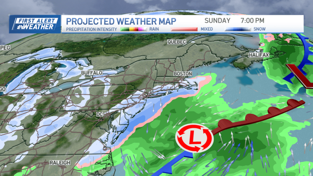
Sunday we start off colder and dry, then by nighttime an offshore low pressure system tracks south of us. We still anticipate this storm system to tap into some colder air in place after a cold front passage on Saturday. And this means a few inches of snow will fall across southeastern New England.
The track and timing is still TBD but the signals for snow are still pretty good for Sunday night into early Monday.

NBC10 Boston
How cold will it be in Boston next week?
After this, the door is wide open for arctic air to flow right in. Some of the coldest temps in two years will arrive with highs in the teens for Tuesday and Wednesday, single digits in northern New England.

NBC10 Boston


